

 Jak nakupovat
Doručení
Nákupní rádce
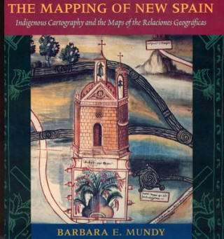
Mapping of New Spain
 Angličtina
 147 b
147 b
30 dní na vrácení zboží
Mohlo by vás také zajímat


Although Cortes conquered the Aztec empire in 1521, imperial Spain knew little about the Mexican territory under its control when Philip II acceded to the throne in 1556. As part of a vast project to learn about its territories in the New World, Spain commissioned a survey - the Relaciones Geograficas - of Spanish officials in Mexico between 1578 and 1584, as king for local maps as well as descriptions of local resources, history, and geography. Offering a contemporary record of what sixteenth-century Mexico looked like, the sixty-nine manuscript maps from this survey also highlight the gulf between colonial and indigenous conceptions of Mexico. In this text Barbara Mundy illuminates the complex cultural negotiations that colonists and indigenes undertook in mapping the colony. She explains the Amerindian and Spanish traditions represented in these early colonial maps, and traces the gradual reshaping of indigenous world views in the wake of colonization.
Informace o knize
Angličtina
Kategorie
