

 Jak nakupovat
Doručení
Nákupní rádce
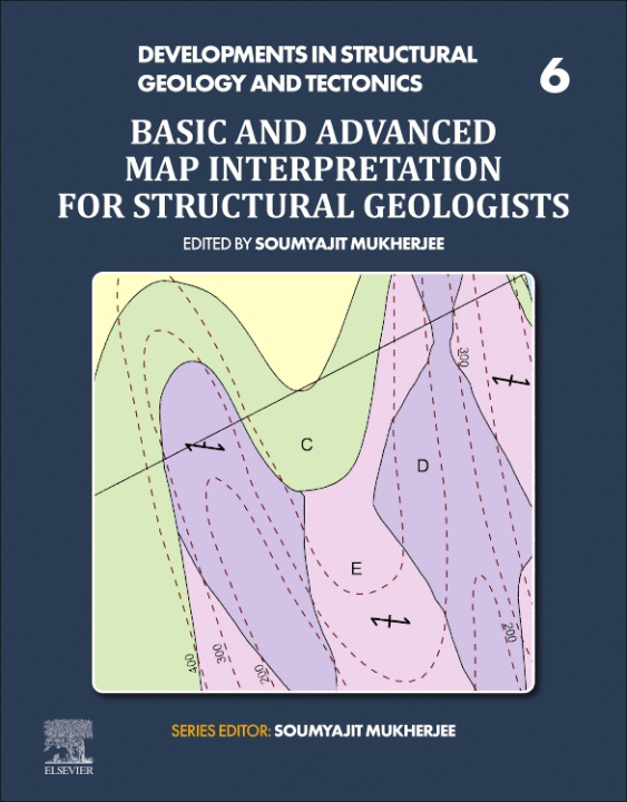
Basic and Advanced Map Interpretation for Structural Geologists
 Angličtina
 401 b
401 b
 Připravujeme
 Termín neznámý
30 dní na vrácení zboží
Mohlo by vás také zajímat


 /
Brožovaná
/
Brožovaná
 643
Kč
643
Kč
Interpretation of Structural Geological Maps: Simple to Advanced Level provides a highly visual manual with many maps and solutions that have not been presented elsewhere for structural geology. Covering rotational faults, listric faults, superposed folds, and other advanced geological formations, along with multicomponent formations that are the most difficult to interpret, this book will guide those who use maps in their work to see two-dimensional geological features in a three-dimensional space and mentally extend them beyond the limits of maps and sections. It includes 21st century mapping capabilities such as LIDAR to provide problems and solutions to interpreting a variety of maps that are available but need specific skills to interpret. Interpretation of Structural Geological Maps: Simple to Advanced Level is a valuable resource for any students, academics, researchers or professionals who work with complex level maps, in order to help them understand how to interpret a variety of structural formations and especially multicomponent formations. Presents a thorough guide on interpretation of maps Includes difficult maps involving superposed folds, rotational faults, listric faults and multi-component maps Presents a self-learning guide of both problems and solutions, with no external instruction required
Informace o knize
Angličtina
Kategorie
